|
|
 |
|
Having crossed the Pyrenees between France and Spain on several occasions, I have been struck each time by the difference between the two sides of the mountain range. Each side marks the frontier of its country, each side is impregnated with the character of the territory which extends beyond its feet.
The differences first express themselves through the geographical nature of each side - this is to be seen in the geological and topographical dissimilarities between the north - granitic - and the south - limestone. The Pyrenees were born through the collision between the Iberian and European tectonic plates. The differences also express themselves in terms of climate, oceanic to the north and mediterranean to the south. One notes a lesser degree of sunshine on the French side, differing rainfall and winds, variations in terms of seasonality... The Spanish side appears to be subjected to a harsher climate, with more extreme changes in temperature.
The cultural landscape mirrors human efforts to tame the natural environment, where agriculture, land management, the exploitation of resources, political regime have all worked together to fashion the morphology of place. France, a historically centralised and monarchic country, has for example modulated the natural landcape through forest management. In Spain, the need for water has created a net of large dams in the valleys in the middle level of the mountains.
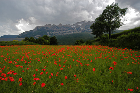
Crossing the Pyrenees elicits one by the great difference between the two sides. The general impression is that the Spanish side is wilder, untamed, even majestic, while the French side is more domesticated, intimate, eventually calmer. Impressions which are certainly subjective, but can one not perceive within the morphology of these mountains an echo of the human character of the populations living on either side?
In early 2004, Espacio Infoculture - a project for cross-frontier cooperation run by Cépière Formation in Toulouse and the Multilatéral Association in Huesca - offered me a residency to undertake an artistic work which would explore and reveal the intimate nature of the land, the sense of place, of the Spanish and French sides of the Pyrenees. The techniques of interactive photography would be put to work as vector of expression.
|
|
Genesis of the Project
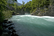
The chosen territory for study is located in the Central Pyrenees. On the Spanish side, it is centred on the village of Torla and the valley of the Ara, in the province of Huesca in Aragon, and it includes the National Park of Ordesa and Monte Perdido. On the French side, it is centred on the town of Cauterets and the valleys around Pont d'Espagne, in the department of the Hautes-Pyrénées, and it includes the Pyrenees National Park.
The photographic work took place over a four week period, divided between two sessions, the first in mid June, towards the end of spring and in the midst of the snow's thaw, the second at the end of July and the beginning of August, in high summer.
I was able to build up a substantial ensemble of photographic views, presenting an in-depth parallel view of the two territories. In total, this is made up of more than 12 000 photographs, belonging to 278 series. Each series or groups of series were established in function of the structure of the work and its interactivity. A typical group of series is built upon the elucidation of a particular place or theme, connected to its inevitable "twin" on the other side of the Pyrenees. Thus, as the work was taking place, the exploration of each place engaged the finding of its cross-frontier counterpart.
There are two types of series. Firstly, photography with a static camera, on a tripod, to record the variations that are inherent to that place. The crash of a torrent, the rhythms of the wind, the slow progression of shadows and clouds. Secondly, photography with a moving camera, so as to construct a dynamic collage of place. Within each scene, the changes may be subtle or radical.
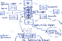
The work, in its current conceptualisation, is composed of four movements, four parallel means of perception of the territory under study. They are articulated about the Brèche de Roland, on the frontier above Gavarnie, which constitutes the pivot where the two sides meet - and which gives the work its name.
Two types of work are currently underway. The first is the complete cataloguing of all the photographs, through the Inventory of Days. This work will gradually be put online, vehiculing a depth of analyse of place made possible by the availability of such a quantity of material.
In parallel, the interactive pictures are being created. These pictures will function through interaction with the observer, via the juxtaposition of landscapes from both sides of the frontier within a collage in a flux of perpetual mutation. The first of these pictures, "Four Corners", at present under production, represents the territorial perimeter of the work...
I thank Espacio Infoculture - and in particular Véronique Humbert, Angélique Pinon, Joaquín Tejero, Lucas Silvestre - for having allowed me to undertake this work, and for their infinite patience... |
|
|